A Neighbourhood Plan for Brickhill
Following completion of all the Neighbourhood Plan steps, it was formally made (adopted) by the Borough Council’s Executive on 25th March 2026. The Neighbourhood Plan will now be used when considering any planning decisions within Brickhill in the future.
The Final Decision Statement issued by Bedford Borough Council can be viewed here:-
The Neighbourhood Plan adopted and used for Planning purposes going forward can be viewed here:-

What is a Neighbourhood Plan?
In simple terms, a neighbourhood plan is:
- A document that sets out planning policies for the neighbourhood area – planning policies are used to decide whether to approve planning applications
- Written by the local community, the people who know and love the area, rather than the Local Planning Authority
- A powerful tool to ensure the community gets the right types of development, in the right place.
Many parishes in Bedford Borough have Neighbourhood Plans. In most of these a key part has been the allocation of sites for housing and other development. In the Borough Local Plan there are no sites identified for development in Brickhill parish and none are proposed as part of this plan.
Protecting Brickhill’s green open spaces
Protecting Brickhill’s green open spaces
Brickhill has a large number of green open spaces, but only Waveney Green. the North Brickhill Country Park and Clapham Park wood are officially designated as Local Green Spaces. Brickhill Parish Council has previously tried to get other open spaces also designated as Local Green Spaces, but was unsuccessful. The Neighbourhood Plan is another opportunity to increase the protection for key areas. The Neighbourhood Plan working group identified seven areas of special value for the Brickhill community:
- Brickhill Drive / Foster’s Brow open space
- Brickhill Drive / Rooksmead Pond open space
- Falcon Avenue green corridor
- Robin Hill
- Merlin Gardens
- Carron Road kick-about space
- Meadow off Crispin Drive

Rooksmead Pond
Rooksmead pond with fountain, surrounded by trees and native fauna
Why designate an area as Local Green Space?
Local Green Space (LGS) designation is a way to provide special protection against development for green areas of particular importance to local communities. Once designated, the LGS is subject to the same strong development restrictions as Green Belt, and new development here is ruled out other than in special circumstances.
Though there are no proposals to affect these seven sites, given their importance to the Brickhill community the Neighbourhood Plan is the best way to protect them for the long term.
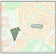
Foster's Brow & Rooksmead
Green Spaces

Foster's Brow
Foster's Brow Green Space
Why these seven sites?
The Neighbourhood Plan working group believes that there is strong evidence for the importance of these sites for Brickhill.
Brickhill Drive/Rooksmead Pond open space
The open aspect of the site, with mature trees and the pond with fountain is not just a beautiful site, but is popular with residents. Children often play on the open space. Residents are often found sitting on the bench overlooking the pond.
Brickhill Drive/Foster’s Brow open space
Located at the top of Brickhill Drive, the site provides a visual gap between Brickhill and adjacent development. The space is also used for recreation, including by the Brickhill scout group.
Falcon Avenue green corridor
This forms a link to Brickhill’s past. It follows the route of a former carriage driveway to Clapham House, running from Kimbolton Road to Hawk Drive. The tree-lined path between the two carriageways in Falcon Avenue serves as a wildlife corridor as well as a path for the public.


Falcon Avenue
Green Corridor
Robin Hill
This open space adds significantly to the open character of Brickhill, it also serves to connect the open spaces of Bedford Park with Merlin Gardens, Falcon Avenue and Waveney Green.
Merlin Gardens
This open space adds significantly to the open character of Brickhill, it also serves to connect the open spaces of Bedford Park and Robin Hill, through to Falcon Avenue and Waveney Green.
Carron Road kick-about space
The open aspect of the site connects to the football pitches and North Brickhill Country Park on the northern side of Ashmead Road. It is used for recreation, including informal football, a green gym and is well used by wildlife, with one part of the site serving as a balancing pond in case of excessive rain, but also a useful habitat for plants and wildlife.
Meadow off Crispin Drive
This site is directly connected to the plantation areas currently designated as Local Green Space and from all practical points of view is seen as being part of North Brickhill Country Park. The open aspects of the site give great views of the countryside and are well used by local residents for recreation, as can be seen by the many pathways through the site, caused by the passage of walkers.
Archaeological digs in the early 2000s found four areas of interest, which included some remains from the early to middle Iron Age.
Main themes of the Neighbourhood Plan
The Neighbourhood Plan consists of four themes:
Sustainable Growth: To ensure that any development in Brickhill is sustainable and proportionate, to help create prosperity and meet the needs of the community.
Local Environment: To protect Brickhill’s environment and green spaces to support the health and well-being of current and future generations.
Sustainable Design: To ensure that development in Brickhill is well-designed, safe and sustainable.
Transport and Paths: To support more sustainable live/work patterns and movement, including walking and cycling.
There is also a section on sustainable design.
There are no sites designated for building in Brickhill in the Local Plan 2030. Any development that happens is likely to be small-scale, such as the replacement of dwellings that has taken place in Kimbolton Road or small infill developments such as took place in the former BPHA garage blocks off Mallard Hill and Brickhill Drive. The policies relating to development are there to cover these eventualities.